



Hiking in Sedona: The Complete Trail Guide to Subway Cave, Cathedral Rock & Beyond
By Traveling Portrait · travelingportrait.co
Red rock spires, slot-canyon light, and trails that end at natural sandstone arches — it's no wonder hiking in Sedona, Arizona draws visitors from around the world. Whether you're chasing the perfect photo at the Subway Cave or testing your legs on the scramble up Cathedral Rock, Sedona's Coconino National Forest trail network has something for every hiker, from casual walkers to canyon scramblers.
This guide breaks down two of Sedona's most iconic hikes — the Subway Cave and Cathedral Rock Trail — along with the permits, timing, and gear you need to hike them safely. We'll also round up a few more don't-miss trails to help you build out a multi-day Sedona hiking itinerary.
Why Sedona Is One of the Best Hiking Destinations in the Southwest
Sedona sits at the mouth of Oak Creek Canyon, where red sandstone formations rise straight out of juniper and pine forest. The terrain is part of what makes hiking in Sedona so distinct: short trails can pack in dramatic elevation gain, sweeping views, and unique geology like natural arches, vortex sites, and swirling rock "subways" carved by centuries of erosion. Most trailheads sit within a 20-minute drive of downtown Sedona, so it's realistic to hike two or three trails in a single day.
Before you set out, know this: nearly every trailhead in Coconino National Forest, including Subway Cave, Cathedral Rock, Devil's Bridge, and Bell Rock, requires a Red Rock Pass. Passes cost $5 for a day, $15 for a week, or $20 for an annual pass, and they're available at self-pay stations, the Sedona visitor center, and local gas stations. An America the Beautiful annual pass also covers parking at these trailheads (though a few spots, like West Fork and Crescent Moon Ranch, require a separate Coconino Pass).
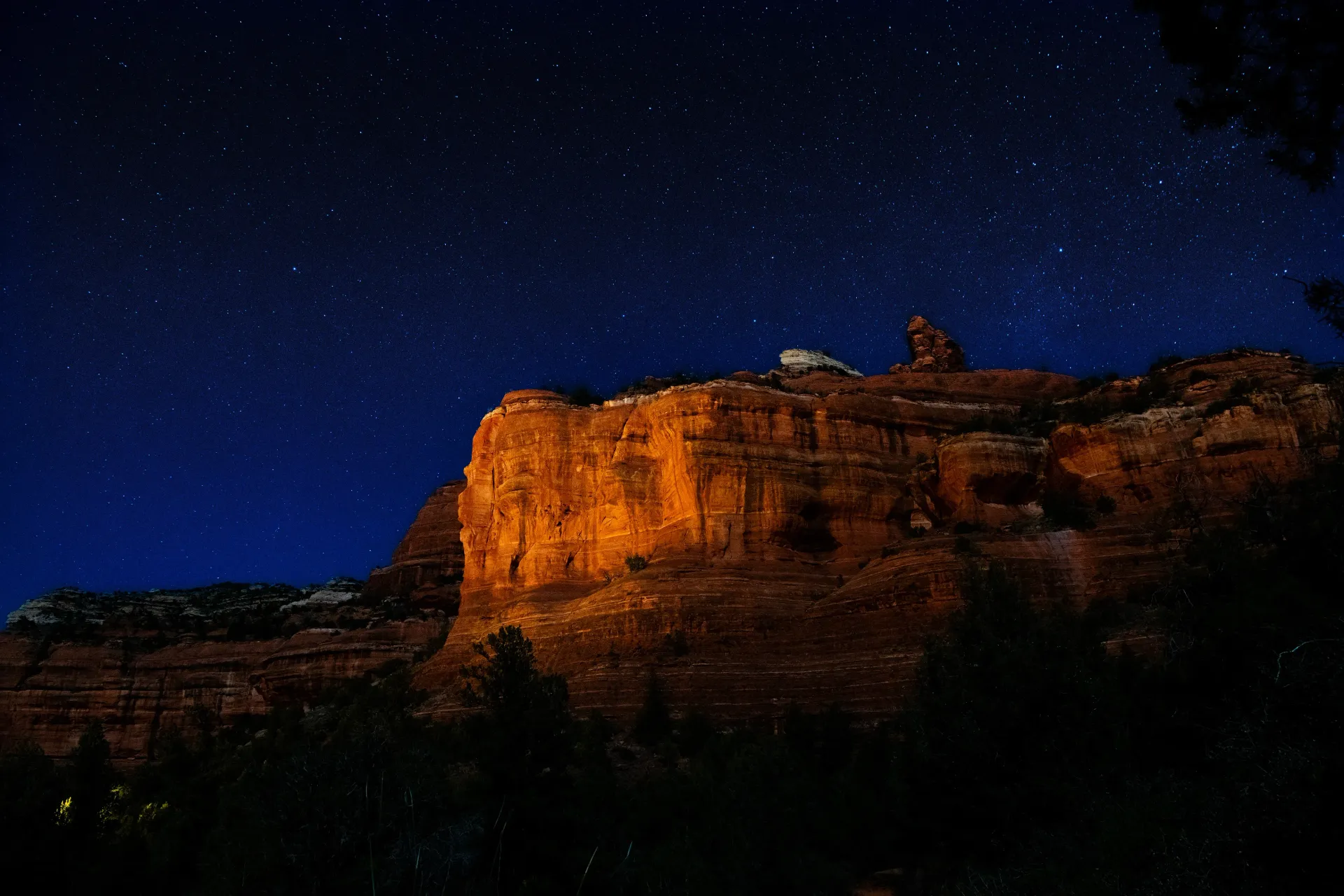
Hiking to the Subway Cave in Sedona
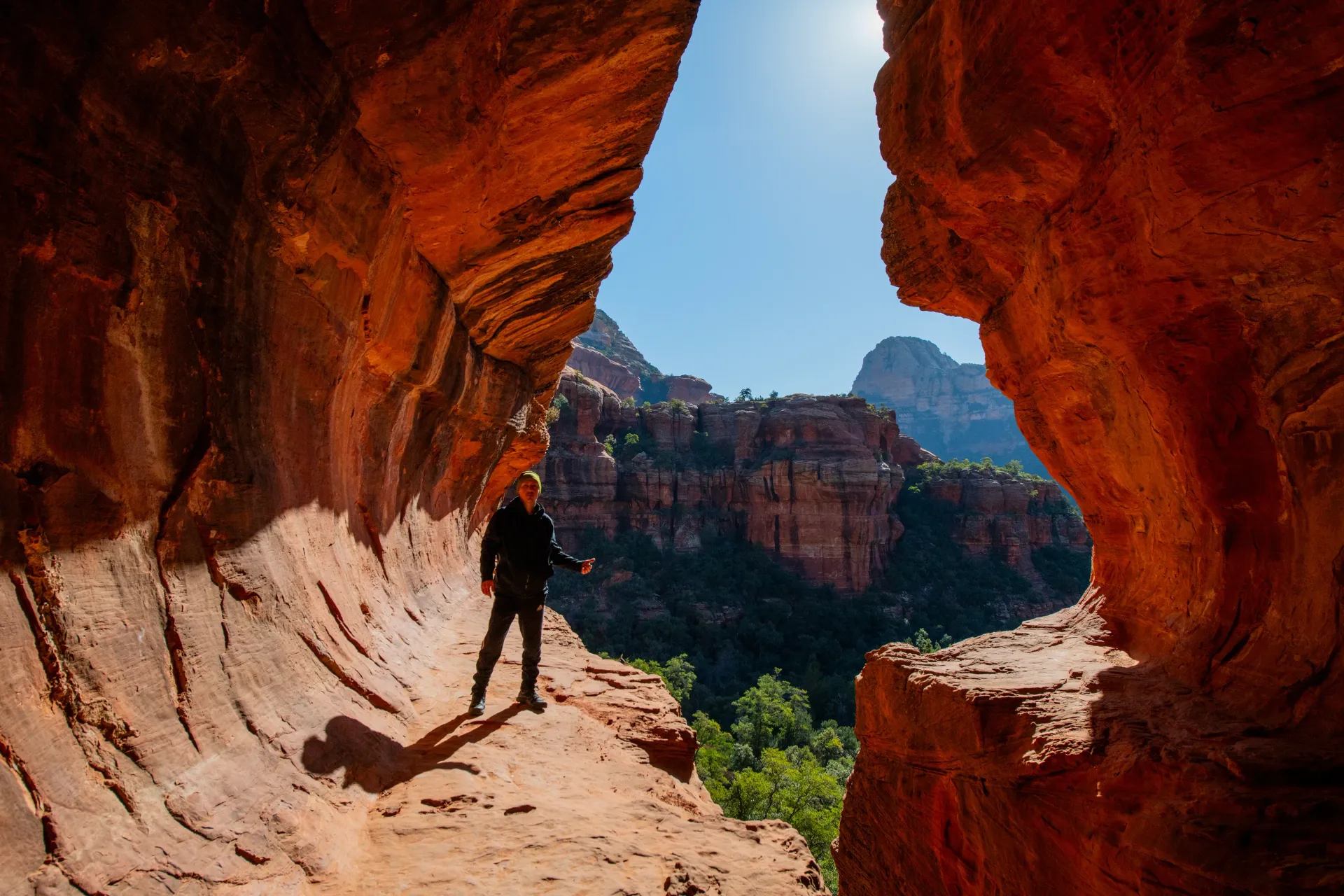
The Subway Cave is one of Sedona's most photographed — and least marked — natural features. Tucked into a side canyon off Boynton Canyon, this 75-foot-long, 25-foot-wide alcove has a swirling, tunnel-like ceiling that looks almost otherworldly in person, which explains why it's become a bucket-list stop for photographers and Instagram hikers alike.
Trail stats:
- Distance: about 5.4 miles round trip from the Boynton Canyon Trailhead
- Elevation gain: roughly 490 feet
- Difficulty: easy to moderate, with one short scramble
- Trailhead: Boynton Canyon Trailhead, off Boynton Canyon Road in West Sedona
Getting there: From Highway 89A, head north on Dry Creek Road, which becomes Boynton Pass Road. Turn right onto Boynton Canyon Road and look for the Boynton Canyon Trailhead on your right.
On the trail: Follow the main Boynton Canyon Trail for about two miles until you reach a distinctive juniper tree with bark that resembles alligator skin. Take the unmarked spur trail to the right here and continue roughly half a mile to reach the cave entrance. Because the turnoff isn't officially signed, downloading an offline map or GPS track before you go is worth the extra five minutes.
Reaching the cave itself requires a short scramble up a rock chute, which is manageable for most hikers with decent mobility. If you're not comfortable scrambling, there's a slightly longer, easier route around to the left.
Best time to hike: Spring and fall mornings or late afternoons keep you out of peak heat, and the softer light makes for much better photos inside the cave.
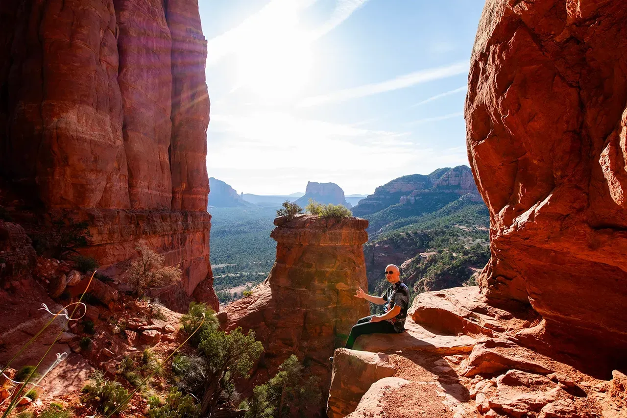
Trail stats:
- Distance: about 1.2 miles round trip
- Elevation gain: approximately 700 feet
- Duration: 1 to 2 hours
- Difficulty: moderate to strenuous (the U.S. Forest Service rates it this way, and it's an accurate call)
- Trailhead: Cathedral Rock Trailhead, off Back O' Beyond Road
Don't let the short distance fool you. This is more rock climb than hike: the trail ascends steeply over bald sandstone and through a narrow cleft with a few notched toeholds, so you'll want both hands free. There's no shade for most of the route, and the final push to the saddle involves real scrambling, not just a steep walk.
Hiking Cathedral Rock: Sedona's Iconic Sunset Trail
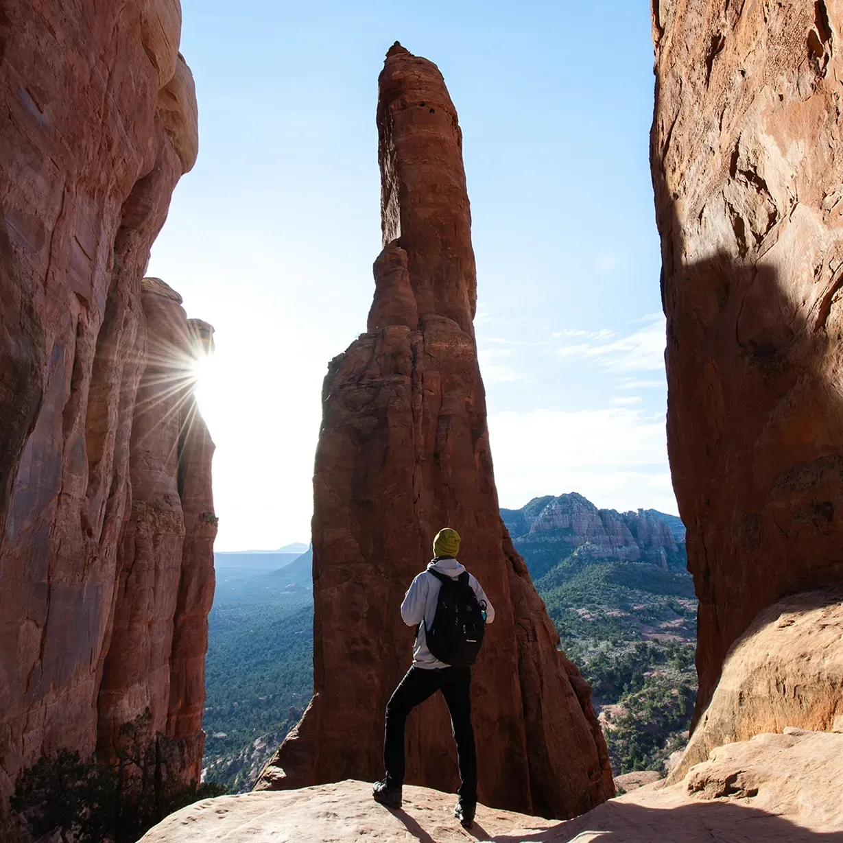
If one photo defines hiking in Sedona, it's probably the view from Cathedral Rock. Its four red sandstone spires are visible from nearly every angle in the Village of Oak Creek, and the trail up to the saddle is one of the most rewarding — and most strenuous — short hikes in the region.
Parking note: The Cathedral Rock Trailhead lot closes Thursday through Sunday year-round while the Sedona Shuttle is running (7 a.m. to 5:30 p.m.). On those days, you'll need to park at a shuttle hub and ride in, so plan extra time.
Best time to hike: Cathedral Rock is widely considered Sedona's best sunset hike. Time your ascent so you're on the saddle as the spires start to glow gold and red in the evening light. Bring a headlamp for the descent, since the rock can be tricky to navigate in the dark, and always carry more water than you think you'll need, there's no water source and very little shade on the way up.
More Top Sedona Hikes to Add to Your Itinerary
If you have more than a day in Sedona, these trails pair well with Subway Cave and Cathedral Rock:
Devil's Bridge — The largest natural sandstone arch in the Sedona area, and one of the most photographed spots in Arizona. It's about 3.9 miles round trip with roughly 521 feet of elevation gain, and the well-maintained surface makes it approachable for fit beginners.
Bell Rock Pathway — An easy, mostly flat 3.6-mile trail with sweeping views of Bell Rock and Courthouse Butte. A good pick for families or anyone easing into red rock hiking.
West Fork Trail — Located in nearby Oak Creek Canyon, this roughly 6.5-mile round trip follows a creek through towering canyon walls and lush vegetation, a striking contrast to Sedona's desert terrain and a great half-day option.
Sedona Hiking Tips: Permits, Safety, and Packing
A few practical notes to keep your hike smooth and safe:
Permits: Buy your Red Rock Pass before you arrive at the trailhead if possible; self-pay stations don't always have exact change or working card readers.
Water: Arizona's high desert climate is deceptive. Even in cooler months, carry at least one liter per person for every two hours of hiking, more for exposed, strenuous routes like Cathedral Rock.
Timing: Summer temperatures in Sedona regularly top 100°F. Hike early morning or evening from May through September, and save mid-day slots for spring and fall.
Footwear: Sedona's sandstone can be slick, especially near scrambles like Subway Cave and Cathedral Rock. Trail runners or hiking boots with solid grip make a real difference.
Navigation: Several popular trails, including the Subway Cave spur, aren't clearly signed. A GPS app or downloaded offline map prevents backtracking and keeps you from missing the turn.
Plan Your Sedona Hiking Trip
Sedona rewards hikers who plan ahead, from timing the light at Cathedral Rock to finding the unmarked turnoff to the Subway Cave. Whether you're building a single epic day around these two iconic hikes or stringing together a full week of red rock trails, a little preparation turns a good hike into an unforgettable one.
Looking for more Arizona travel inspiration and trip-planning help? Explore more guides and travel resources at Traveling Portrait.