Quick Stats — Navajo Loop Trail
- Distance: 2.9 miles (loop)
- Elevation Change: 550 feet
- Difficulty: Moderate
- Starting Elevation: ~8,000 feet above sea level
- Best Trailhead: Sunset Point
- Estimated Time: 1.5 – 2.5 hours
- Dogs Allowed: No
- Permit Required: No (park entrance fee applies)
- Shuttle Stop: Sunset Point (Free park shuttle)
There are landscapes that you see with your eyes, and then there are landscapes that reach into your chest and rearrange something. Bryce Canyon National Park is the second kind.
Standing at the rim of Bryce Amphitheater for the first time, looking down into a cathedral of rust-red and cream-white hoodoos rising from the canyon floor like a frozen army of stone giants, you feel a very specific brand of disbelief.
Your brain keeps insisting that what you're looking at isn't real — that it was painted by someone with an overactive imagination and access to a very unusual color palette.
Then you step onto the Navajo Loop Trail, begin descending 550 feet into the heart of it, and the disbelief evaporates. The red rock walls close in around you. The sound of the world above fades. And you are completely, utterly inside one of the most extraordinary places on Earth.
This guide is the most complete resource on Bryce Canyon National Park and the Navajo Loop Trail you'll find online.
I've walked every step of it, photographed every shadow angle, and packed in the practical details that other travel blogs skim over.
Whether you're planning your first visit or your fifth, this is your definitive reference.
What Is Bryce Canyon National Park?
Despite its name, Bryce Canyon National Park is not technically a canyon — at least not in the traditional geological sense.
While the Grand Canyon was carved by a river cutting downward, Bryce was sculpted by a process called frost wedging and erosion, where snowmelt seeps into cracks in the rock, freezes, expands, and slowly breaks the limestone and dolomite apart over millions of years.
The result is the hoodoo — a towering, irregular column of sedimentary rock that exists almost nowhere else on Earth in such concentration or drama.
Bryce Canyon sits on the Paunsaugunt Plateau in southern Utah at an average elevation of 8,000 to 9,000 feet, making it significantly higher than many visitors expect.
The park protects 35,835 acres and is part of the Grand Staircase — a massive geological staircase of rock layers that descends from Bryce all the way to the Grand Canyon.
The park receives approximately 1.5 to 2 million visitors per year, and for good reason. Bryce Canyon National Park is one of the most visually striking places in the entire American Southwest — and arguably the most surreal landscape in the contiguous United States.
Getting to Bryce Canyon National Park
Bryce Canyon National Park sits in Garfield County, Utah, roughly:
- 4.5 hours from Las Vegas, Nevada (most common fly-in city)
- 4.5 hours from Salt Lake City, Utah
- 1.5 hours from Zion National Park
- 2.5 hours from Capitol Reef National Park
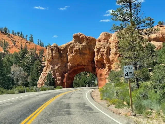
The main entrance is on Utah Route 63, which dead-ends at the Bryce Canyon Visitor Center.
From there, a single 18-mile scenic road runs south through the park with overlooks and trailhead access along the way.
Driving Scenic Byway 12 from the east (coming from Capitol Reef or Escalante) is one of the most spectacular highway drives in North America. The road twists and climbs through canyon lands, slickrock ridges, and high meadows before delivering you to the park's edge.
If you have the time, take it.
You won't regret it.
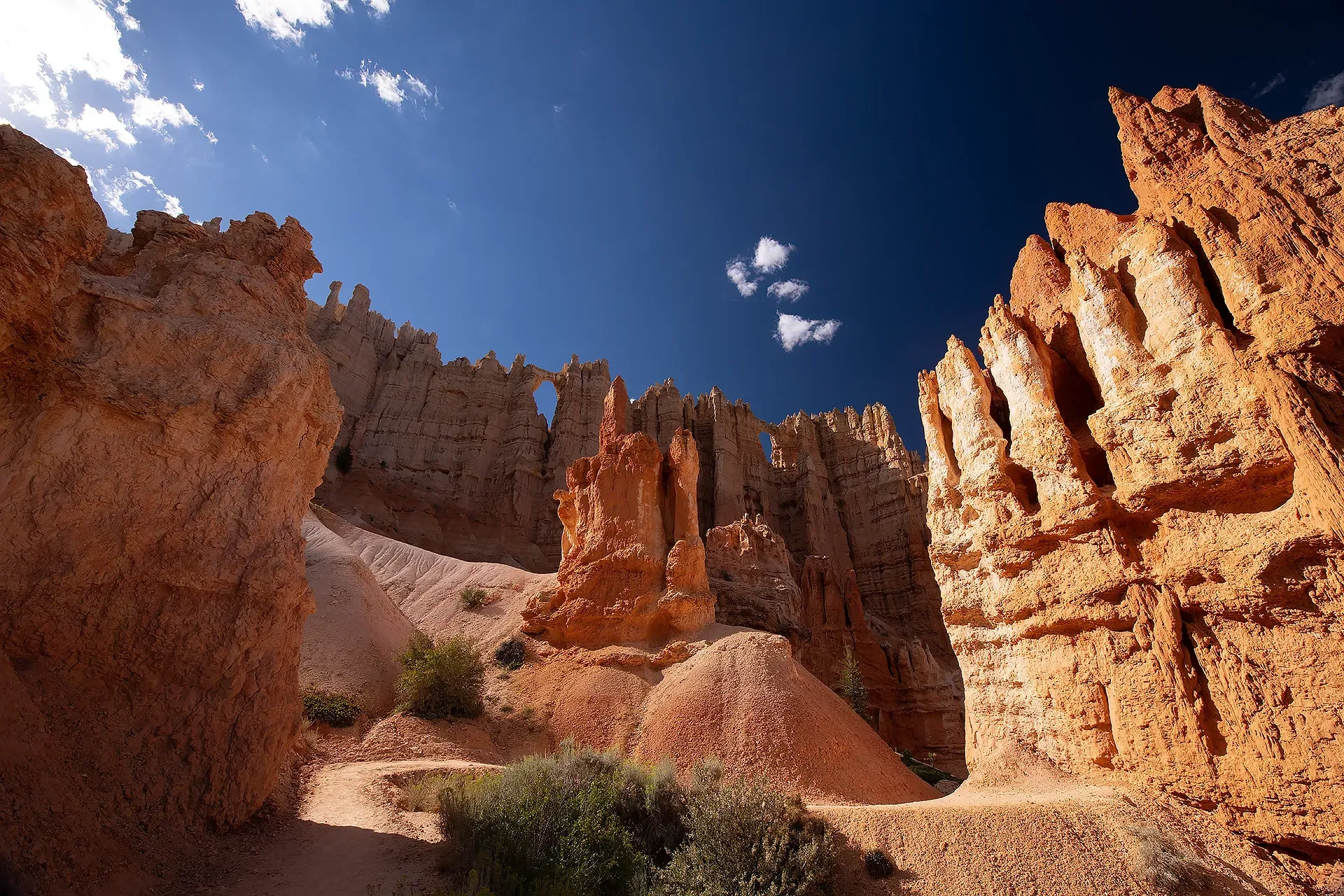
Best Time to Visit Bryce Canyon National Park
Bryce Canyon National Park is spectacular in every season — and each season offers a genuinely different experience.
That said, your "best" time depends entirely on what you want.
Spring (April – May)
Spring is ideal for hikers who want comfortable temperatures without peak summer crowds.
Expect daytime highs in the 50°F at the rim. Snow may still cling to shadowed sections of the Navajo Loop Trail through April. Wildflowers begin appearing in May along the rim and meadows.
This is one of the best windows for photography — the low-angle spring light paints the hoodoos in shades of copper and amber that summer can't match.
Summer (June – August)
Summer is peak season. The park is busy, parking lots fill before 9am, and the shuttle system becomes essential.
Afternoon thunderstorms are common and can be dangerous on exposed trails — plan to be back at the rim by early afternoon.
That said, summer evenings at Bryce are magical: the park is a
designated International Dark Sky Park, and on clear nights the Milky Way rises directly over the amphitheater in a way that makes you feel very small and very grateful.
Fall (September – October)
Arguably the finest season for hiking Bryce Canyon National Park.
Crowds thin after Labor Day, temperatures drop to pleasant highs in the 60°F, and the Ponderosa Pines and aspens add gold and amber to the red-rock backdrop.
The air is crisp and clear. Visibility is at its best.
If your schedule allows it, come in late September.
Winter (November – March)
Don't sleep on winter at Bryce Canyon.
Snow-dusted hoodoos are among the most photographed scenes in the entire national park system — the white snow against the orange and red rock creates a contrast so vivid it looks composited.
Snowshoeing on the Navajo Loop Trail is permitted and extraordinary.
The park is quieter, the light is lower and warmer, and the experience is unlike anything summer visitors ever see.

Bryce Canyon National Park Fees & Passes
As of 2026, the Bryce Canyon National Park entrance fee is:
- $35 per vehicle (7-day pass)
- $30 per motorcycle (7-day pass)
- $20 per person on foot or bicycle (7-day pass)
If you plan to visit multiple national parks on your trip — and you should, because Zion, Capitol Reef, and Arches are all within driving distance — the America the Beautiful Annual Pass at $80 covers entrance to all U.S. National Parks for a full year and pays for itself in a single trip.
The park does not require advance reservations for day hikes, including the Navajo Loop Trail. Camping reservations are strongly recommended and can be made at recreation.gov.
The Navajo Loop Trail: A Complete Step-by-Step Guide
If you only have time for one hike at Bryce Canyon National Park, make it the Navajo Loop Trail. Full stop.
At 2.9 miles round trip with 550 feet of elevation change, it's short enough to complete in under three hours — but what those three hours deliver in visual drama is completely out of proportion to the effort involved.
This is the hike that makes people cry. Not because it's hard, but because of where it takes you.
The Navajo Loop Trail: A Complete Step-by-Step Guide
If you only have time for one hike at Bryce Canyon National Park, make it the Navajo Loop Trail. Full stop.
At 2.9 miles round trip with 550 feet of elevation change, it's short enough to complete in under three hours — but what those three hours deliver in visual drama is completely out of proportion to the effort involved.
This is the hike that makes people cry. Not because it's hard, but because of where it takes you.
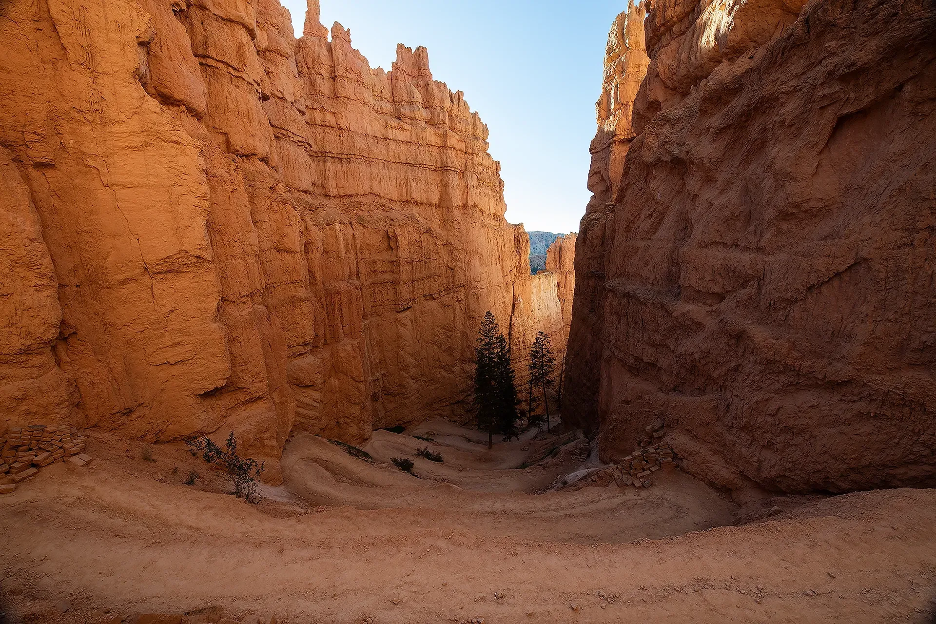
[insert image here — looking down the Navajo Loop Trail switchbacks from Sunset Point, showing the steep descent into the canyon]
Trailhead: Sunset Point
The Navajo Loop Trail begins and ends at Sunset Point, one of the most iconic overlooks in Bryce Canyon National Park.
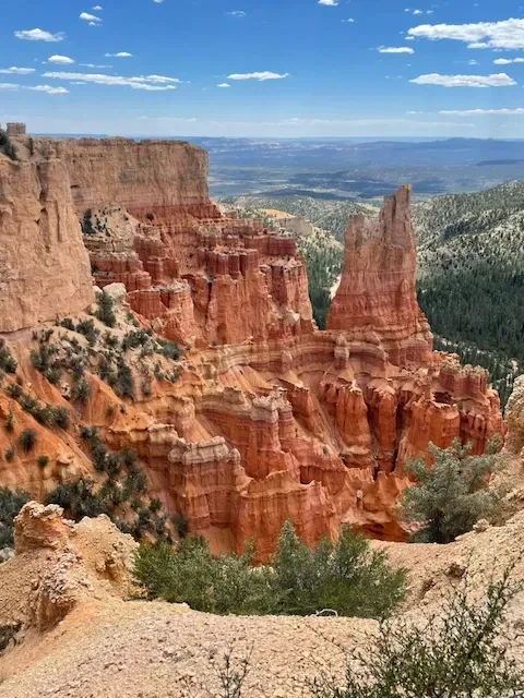
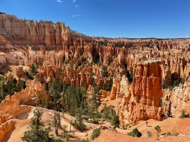
The viewpoint sits at the rim of Bryce Amphitheater and offers a panoramic sweep of hoodoos stretching from Sunrise Point to the south.
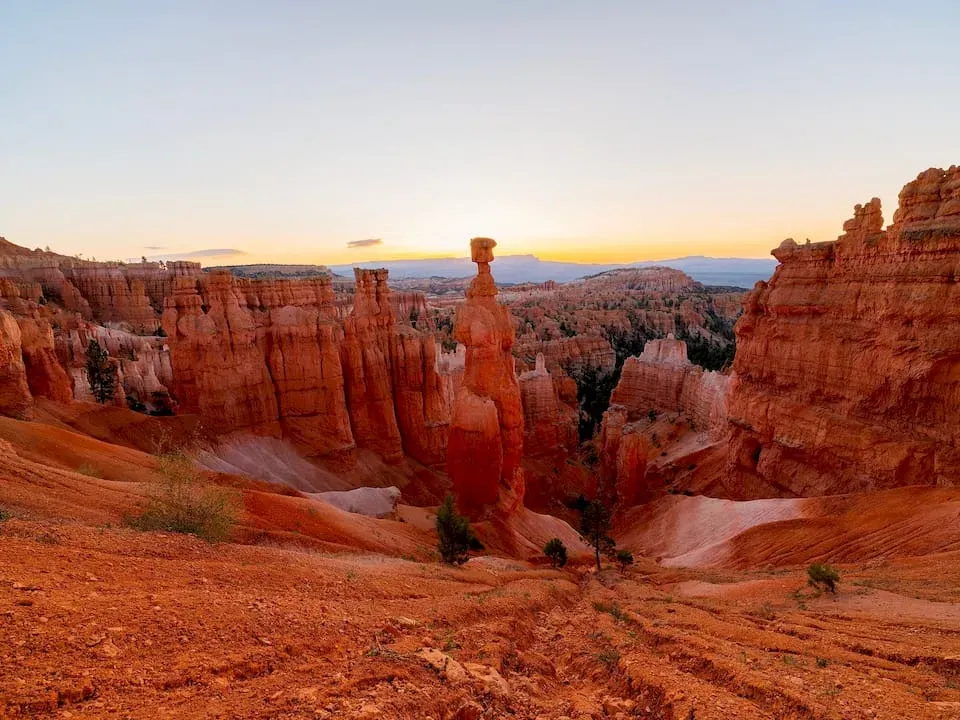
Thor's Hammer — perhaps the most famous rock formation in the park — is visible directly below.
Sunset Point has its own parking area with limited spaces.
During summer, arrive before 8:30am or take the
free Bryce Canyon Shuttle, which runs approximately every 12–15 minutes between stops and is the most stress-free way to access the trailhead.
The Descent: Into the Hoodoos
From Sunset Point, the trail begins with a series of steep, well-maintained switchbacks that drop you off the rim and into the canyon below.
The first section is the most physically demanding — not because the footing is technical, but because the views are so relentlessly good that you keep stopping to stare instead of walking.
As you descend, the scale of the hoodoos shifts in a way that photographs cannot fully prepare you for.
From the rim, they look tall. From the canyon floor, they are enormous — some reaching over 200 feet.
The colors deepen as you drop: the pale pink and cream of the upper formations gives way to burnt orange, deep brick red, and chocolate brown near the base, all of it layered in horizontal bands like a geological birthday cake.
At around the 0.4-mile mark, you'll reach the
canyon floor and the trail levels out into the first of two distinct sections: the open hoodoo valley and the famous
Wall Street corridor.

Wall Street: The Heart of the Navajo Loop Trail
Wall Street is the section of the Navajo Loop Trail that most people come to experience — and the reason most of them come back.
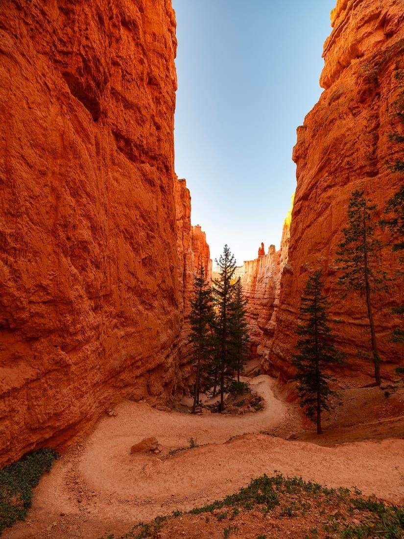
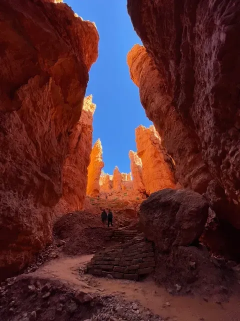
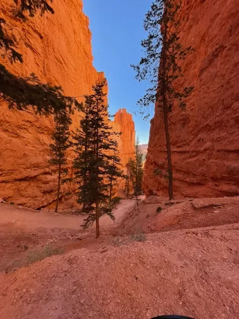
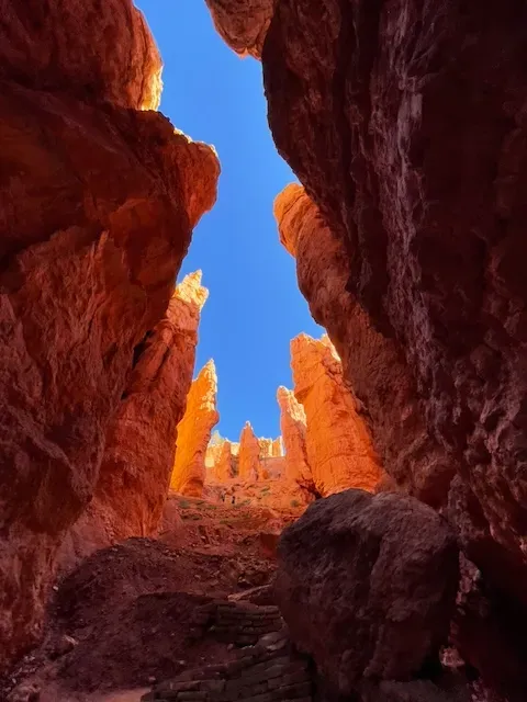
Named for its resemblance to the narrow, towering streets of lower Manhattan, Wall Street is a slot-canyon-like passage where the trail threads between sheer walls of hoodoo rock rising hundreds of feet on either side.
The walls close to within a few feet of each other in places, blocking out the sky until only a thin ribbon of blue is visible above.
The light that filters down is diffuse and golden and unlike anything in ordinary experience.
Walking through Wall Street feels less like hiking and more like passing through a cathedral.
The acoustics change.
Your voice echoes differently.
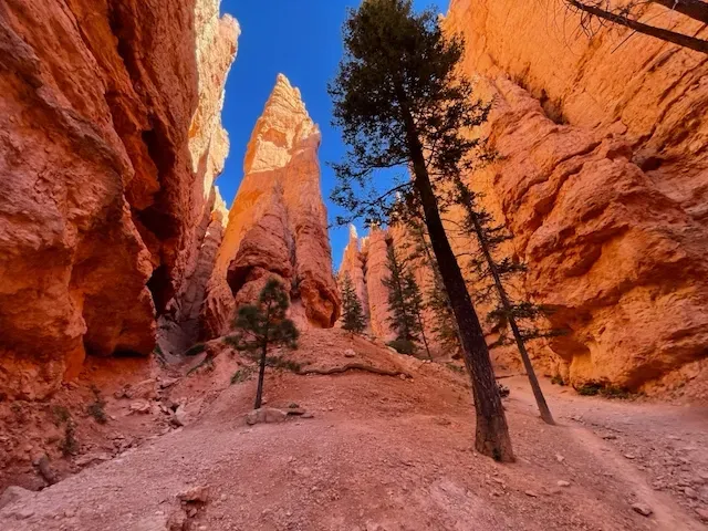
The temperature drops several degrees even on a warm afternoon. And the rock formations on either side — some balanced improbably on narrow pedestals, some streaked with iron oxide in shades of red and purple and rust — are so intricate and so close that you can reach out and touch millions of years of history with your fingertips.
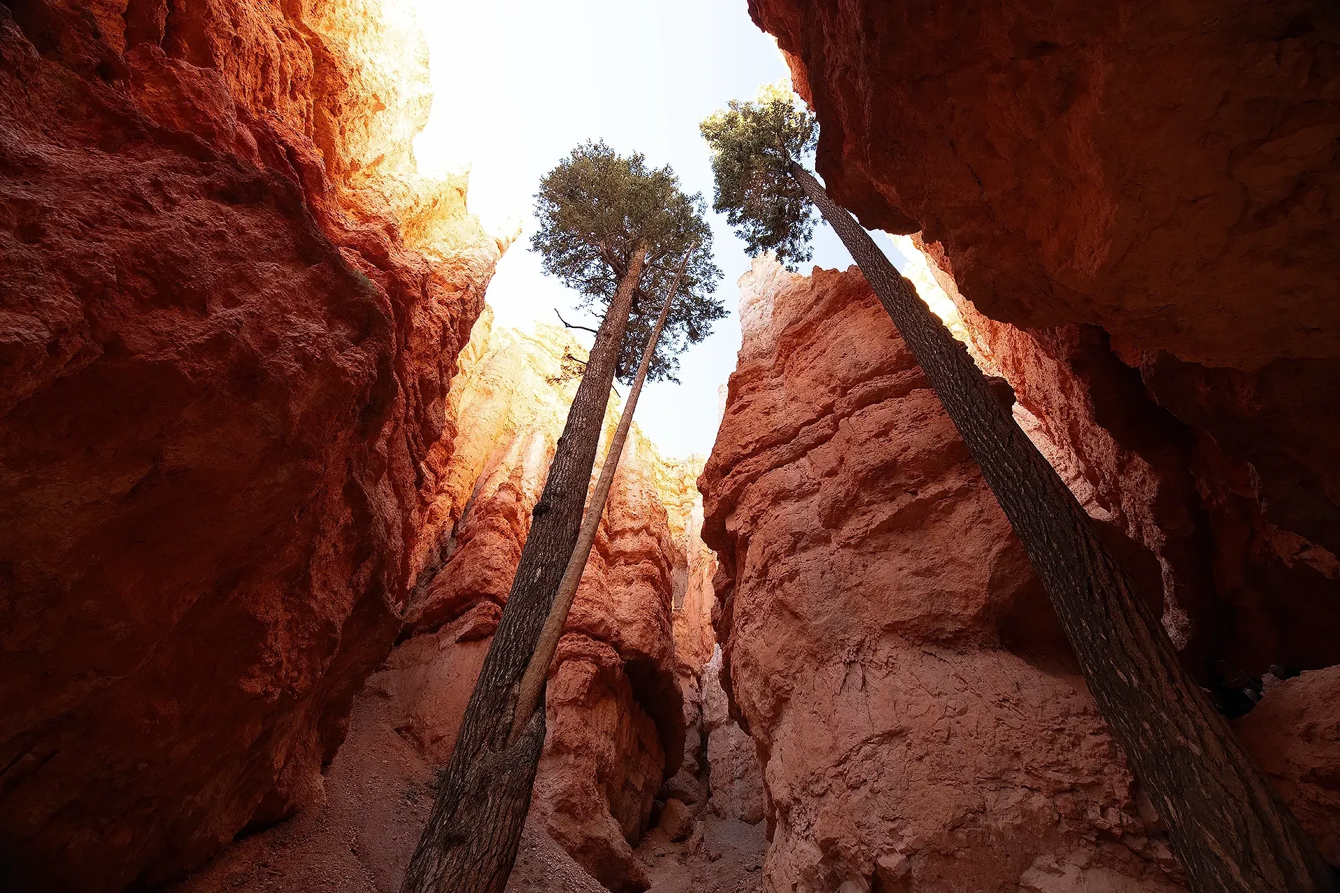
Two ancient Ponderosa Pines grow directly from the canyon floor in the heart of Wall Street, their roots having somehow found purchase in the solid rock. They've been there for centuries.
Standing beside them, looking straight up at the walls of hoodoos with those old trees for company, is one of the quieter and more profound moments this park offers.
Thor's Hammer and the Windows
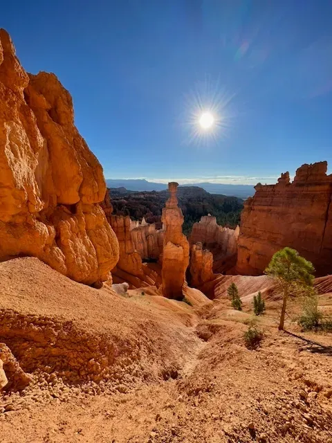
As you loop back toward the ascent, the trail opens up and offers clear sight lines to Thor's Hammer — a perfectly balanced, anvil-shaped hoodoo perched high on the canyon wall.
Thor's Hammer is the single most photographed formation in Bryce Canyon National Park, and for good reason: its shape is almost cartoonishly perfect, as though a sculptor decided to demonstrate what a hoodoo should look like and then made one.
It's visible both from the rim above at Sunset Point and from specific angles within the canyon below.
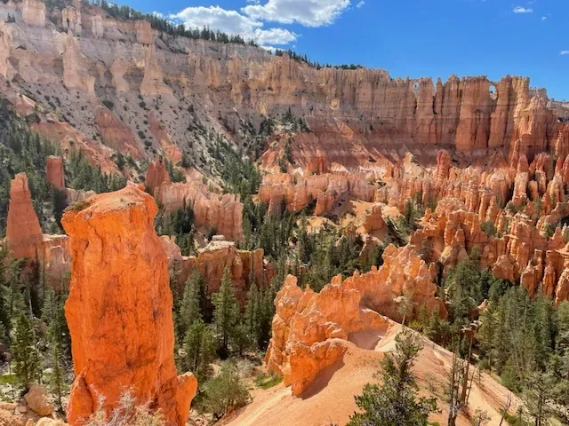
Also visible from this section is the Wall of Windows — a row of arched openings eroded through a long fin of rock, creating a series of natural frames that look out over the canyon beyond.
The Wall of Windows is best photographed in the late morning when light comes through the openings and illuminates the rock from behind.
The Ascent: Coming Back Up
The return ascent from the canyon floor to Sunset Point is where the Navajo Loop Trail earns its "moderate" rating — and where the altitude earns its reputation.
You are hiking at approximately 8,000 feet above sea level, and if you live anywhere near sea level, you will feel it on the way back up.
Take your time. Drink water. Stop and breathe and look around.
There is absolutely no shame in moving slowly at this altitude — even seasoned hikers take breaks.
The switchbacks on the ascent offer a completely different visual perspective than the descent. Looking back down into the canyon as you climb, the hoodoos arrange themselves into constantly shifting compositions.
Light and shadow play across the formations differently from above than from below.
Photographers who want the best variety of shots should plan to shoot on both the descent and the ascent rather than putting the camera away for the return.
Extending Your Hike: Navajo Loop + Queen's Garden Combo
The single best use of a half-day at Bryce Canyon National Park is the Navajo Loop and Queen's Garden combination trail — a 4-mile circuit that most visitors rate as the finest hiking experience in the park.
The route works like this: descend into the canyon via the Navajo Loop at Sunset Point, complete Wall Street, then instead of looping back up to Sunset, continue east along the canyon floor onto the Queen's Garden Trail.
This trail wanders through a section of the hoodoo field known as Queen's Garden, where the formations are slightly less vertical and more spread out — giving a completely different character than Wall Street.
Follow Queen's Garden up the canyon wall and emerge at the rim at Sunrise Point, approximately 0.5 miles east of where you started. Walk the rim trail back to Sunset Point.
This combination is 4 miles total and adds roughly an hour to your time below the rim. It is unambiguously worth it.
The two trail sections are so visually different from each other that doing both in a single loop makes the experience feel like two separate hikes.
[insert image here — wide view of Queen's Garden section of trail, hoodoos more spread and rounded in the foreground, blue sky]
Other Hikes in Bryce Canyon National Park
The Navajo Loop is the crown jewel, but Bryce Canyon National Park has a full trail system worth knowing before you visit.
Rim Trail — 11 miles one-way, easy to moderate. Runs the length of the rim from Fairyland Point to Bryce Point. Walk sections of it between shuttle stops for constantly changing views without ever descending into the canyon.
Perfect for families with young children or visitors with limited mobility.
Queen's Garden Trail — 1.8 miles round trip, easy. The most accessible trail into the hoodoos. Ideal as a standalone hike if the Navajo Loop feels too demanding, or as part of the combination route described above.
Peekaboo Loop Trail — 5.5 miles, moderate to strenuous. The longest trail in the Bryce Amphitheater area, descending deeper into the canyon and offering sustained close-up views of formations that shorter trails don't reach.
Horses are allowed on this trail — you may share the trail with guided horseback riders.
Fairyland Loop Trail — 8 miles, strenuous. This trail takes you far from the main amphitheater crowds into the northern section of the park.
The crowds thin dramatically and the scenery, while less concentrated, is more wild and untamed. Best for experienced hikers with a full day and good trail fitness.
Mossy Cave Trail — 0.8 miles, easy. Located on the north end of the park on Highway 12, this short trail leads to a mossy grotto and small waterfall fed by a historic irrigation channel.
The only water feature in the park and a complete change of scenery from the canyon landscape. Best visited early morning or late afternoon — the parking area fills quickly.
Bryce Amphitheater: The Viewpoints
Even if you don't hike a single trail, Bryce Amphitheater viewed from the rim is an experience that justifies the drive.
Four main overlooks define the amphitheater experience:
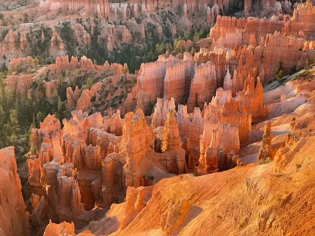
Sunrise Point — Best light: early morning, obviously. The eastern exposure means the hoodoos catch the first angled rays of dawn before shadows fill the canyon.
Plan to be at the rim at least 20 minutes before sunrise. Arrive early — this spot fills up fast on summer mornings.
Sunset Point — The most popular overlook in the park and the Navajo Loop trailhead. The sweeping view from here takes in the full width of the amphitheater with Thor's Hammer prominently in view.
Best light: late afternoon golden hour, when the low western sun floods the canyon walls in deep orange.
Inspiration Point — Set slightly back from the rim and elevated above Sunset Point, Inspiration Point offers the widest panoramic view of the amphitheater.
On clear days you can see for over 100 miles across the canyon into Arizona. This is the viewpoint with the most visual depth and is the best single spot for wide-angle landscape photography.
Bryce Point — The southernmost and highest viewpoint in the amphitheater, sitting at 8,296 feet.
Bryce Point looks down into the widest section of the canyon and offers the best bird's-eye-view perspective of how vast the hoodoo field actually is. It's slightly less crowded than Sunrise and Sunset Points and rewards the extra short drive.
Stargazing at Bryce Canyon National Park
Bryce Canyon National Park is one of the darkest skies in the contiguous United States, designated as an International Dark Sky Park by the International Dark-Sky Association.
With no major cities within 100 miles and minimal light pollution, the night sky above the park on a clear moonless night is something most people from urban environments have literally never seen before.
The Milky Way is visible from mid-spring through early fall, rising over the hoodoos in a way that makes night photography here almost unfairly dramatic.
The park hosts a Bryce Canyon Astronomy Festival each June, typically drawing 1,000+ visitors for talks, telescope viewings, and ranger-led night programs.
Best viewing spots: Sunset Point and Inspiration Point overlooks, which stay accessible at night. The absence of light pollution means the Milky
Way core, thousands of individual stars, and even the Andromeda Galaxy with the naked eye on the right night.
Photography tip: For night photography of the hoodoos, bring a tripod, a wide-angle lens (16–24mm), and shoot at ISO 1600–3200 with exposures of 15–25 seconds. The combination of moonlight (on partial moon nights) and ambient starlight illuminates the canyon walls enough to create silhouettes while keeping the stars pinpoint sharp.
Where to Stay Near Bryce Canyon National Park
Inside the Park
North Campground — The main campground, located a short walk from Bryce Canyon Visitor Center and Sunrise Point. Open year-round (some sites). Book at recreation.gov well in advance for summer dates — these fill months ahead.
Sunset Campground — A short shuttle ride from Sunset Point. Seasonal (spring through fall). More wooded and slightly quieter than North Campground. Reservations essential from May–September.
The Lodge at Bryce Canyon — The only in-park lodging option, with motel units, suites, and rustic cabins. Historic and charming, located in the heart of Bryce Amphitheater. Books out 6+ months in advance for summer dates.
Outside the Park
The town of Tropic, Utah (12 miles east on UT-12) has several motels, vacation rentals, and small inns at lower prices than in-park options.
Bryce Canyon City (just outside the park entrance) has additional hotel options. For a more unique experience, Airbnb and VRBO have tipi and glamping options within a 20-minute drive of the park — they book quickly, but the experience of waking up in the desert within eyeshot of the plateau is worth hunting for.
Photography Tips for Bryce Canyon National Park
Bryce Canyon National Park is a photographer's landscape — the combination of color, texture, scale, and light is extraordinary at almost any hour.
A few things that will immediately elevate your shots:
Chase the golden hours. The canyon walls shift from pale pink to deep amber to dark rust as the sun angle changes. The best light is within the first and last 90 minutes of daylight.
Midday light flattens the textures and washes out the color. Plan your time in the canyon accordingly.
Get into Wall Street. The most dramatic photographs from Bryce Canyon come from inside the canyon, not from the rim.
The rim views are iconic, but the tight angles, the vertical compression, and the close proximity to the rock formations inside Wall Street create images that rim shots simply cannot replicate.
Look for natural frames. The Window formations, arches, and gaps between hoodoos create natural frames within frames — some of the most compelling compositions come from positioning a formation in the foreground to frame the broader canyon view beyond.
Shoot in RAW. The dynamic range between shadowed canyon sections and sun-lit hoodoo tops is extreme.
RAW files give you the latitude to recover highlights and shadows in post. JPEG will blow out or crush the exposure trying to find a middle ground.
Use a polarizing filter. At this altitude with a clear blue Utah sky, a circular polarizer dramatically deepens the blue and boosts the saturation of the red rock, especially in the two hours before sunset.
Practical Information and Tips for Visiting Bryce Canyon National Park
Shuttle System: The free Bryce Canyon Shuttle operates from early April through mid-October, running approximately every 12–15 minutes between the shuttle boarding area in Bryce Canyon City and all major overlooks inside the park.
In summer, using the shuttle is strongly recommended — parking at Sunset and Sunrise Points fills by 9am on weekends and many weekday mornings.
Altitude: You are hiking at 8,000+ feet. If you live below 3,000 feet, expect to feel the altitude on any uphill section. Symptoms of mild altitude adjustment — shortness of breath, slight headache, fatigue — are normal during your first day at elevation.
Drink more water than you think you need. Avoid alcohol the first night. Ascend slowly on switchbacks.
Weather: Southern Utah weather changes fast. Even in summer, afternoon thunderstorms are common and lightning on the exposed rim or canyon walls is dangerous. Check the forecast, start hikes early, and carry a light rain layer.
Water: There is no water available on the Navajo Loop Trail. Carry at least 1 liter per person for a two-hour hike. In summer heat, carry more.
Trekking Poles: Strongly recommended for the steep switchbacks of the Navajo Loop, especially the descent. They significantly reduce knee strain and improve confidence on the steeper sections.
Leave No Trace: Stay on the marked trail at all times. The hoodoos and cryptobiotic soil crust that surrounds them are irreparably damaged by off-trail foot traffic. Do not touch or climb on the hoodoo formations.
Packing List for the Navajo Loop Trail
- Trail-ready footwear with ankle support (trail runners or light hiking boots)
- At least 1.5 liters of water per person
- Sun protection: hat, sunglasses, SPF 30+ sunscreen (UV intensity is high at 8,000 feet)
- Light wind layer or packable rain jacket
- Trekking poles (strongly recommended)
- Camera or charged smartphone
- Snacks (the trail takes 1.5–2.5 hours)
- Park map (available free at the visitor center)
- The America the Beautiful pass or cash/card for entrance fee
Frequently Asked Questions About Bryce Canyon National Park
How long does it take to hike the Navajo Loop Trail at Bryce Canyon? Most hikers complete the Navajo Loop Trail in 1.5 to 2.5 hours. If you combine it with the Queen's Garden Trail into the full 4-mile loop, plan for 2.5 to 4 hours depending on your pace and how much time you spend photographing.
Is the Navajo Loop Trail hard? The Navajo Loop Trail is rated moderate. The trail is well-maintained with clear switchbacks, but the 550-foot elevation change and the 8,000-foot starting altitude make it more physically demanding than a moderate trail at sea level.
Anyone with reasonable fitness can complete it; take breaks and drink water freely.
Can you see the hoodoos without hiking at Bryce Canyon National Park? Yes. All four main overlooks in Bryce Amphitheater (Sunrise Point, Sunset Point, Inspiration Point, and Bryce Point) offer spectacular rim-level views of the hoodoos without any trail hiking required.
The 18-mile scenic drive through the park has 10+ additional overlooks, most of them accessible with a short walk from the parking area.
What is the best hike at Bryce Canyon National Park? The Navajo Loop and Queen's Garden combination trail (approximately 4 miles total) is widely considered the best single hiking experience in the park.
It combines the dramatic canyon descent of the Navajo Loop, the Wall Street passage, and the more open terrain of Queen's Garden into a full loop with maximum variety.
When does Bryce Canyon National Park open? Bryce Canyon National Park is open 24 hours a day, 365 days a year. The visitor center has seasonal hours.
Some campgrounds and the scenic drive south of Rainbow Point may close in winter due to snow.
Do you need a permit to hike the Navajo Loop Trail? No advance permit is required for the Navajo Loop Trail.
You only need to pay the standard park entrance fee ($35 per vehicle as of 2026) or have an America the Beautiful Annual Pass.
Is Bryce Canyon National Park worth visiting? Without hesitation: yes. Bryce Canyon National Park is one of the most visually unique places in the world. There is nowhere else on Earth where hoodoos exist in this concentration or scale.
The park is smaller and more manageable than neighboring Zion or the Grand Canyon, which makes it possible to experience its highlights even in a single day — though two or three days is ideal.
What is the elevation of Bryce Canyon National Park? The main visitor areas and Bryce Amphitheater overlooks sit between 8,000 and 9,100 feet above sea level.
Rainbow Point, at the far southern end of the scenic drive, is the highest point in the park at 9,105 feet.
Final Thoughts: Why Bryce Canyon National Park Stays With You
There are national parks you visit and then there are national parks that visit you back — that follow you home and refuse to let you forget them.
Bryce Canyon National Park is firmly in the second category.
It's the peculiarity of the hoodoos that does it. The way they look different every time the light shifts.
The way Wall Street changes from golden corridor to deep shadow in the span of twenty minutes as the sun moves.
The way you can be standing at the rim surrounded by people and then descend a hundred feet and suddenly feel completely, legitimately alone with something ancient and enormous.
The Navajo Loop Trail is 2.9 miles. It takes less than three hours to complete. And it is, mile for mile, one of the most extraordinary walks you will ever take in your life.
Book the trip.
Traveling Portrait is an adventure travel and photography blog documenting experiences from the American Southwest, Iceland, Alaska, Belgium, and beyond. Visit
travelingportrait.co for more destination guides, gear recommendations, and travel photography tips.
Other Posts You Might Like